How did Shooting Star Wildflower Route and Shooting Star Bike Trail come about? And what is so special about this route and trail?
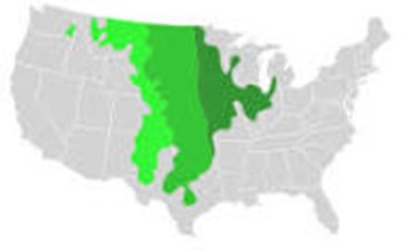
First it helps to know where in the world we are. What is sometimes called “the breadbasket” of the United States, some say the world, was, less than two hundred years ago a landscape of millions of acres of tall, mid and short grass prairie. These natural areas were home to many tribes of people who lived in harmony with these prairie ecosystems, following the ebb and flow of the seasons along with hundreds and thousands of species of plants and wildlife.
Dark green: Tallgrass prairie
Medium green: Mid grass prairie
Lighter green: Short grass prairie
Medium green: Mid grass prairie
Lighter green: Short grass prairie
Early European immigrants at first thought this grassy plain was “good for nothing” because it “couldn’t even grow trees!” Yet the prairie ecosystem provided life for thousands of species of animals, birds, insects, reptiles and amphibians, grasses, wildflowers, shrubs and a scattering of trees along water ways and uplands. It is often said about prairie that it is similar to an iceberg – one-third is visible above ground and two-thirds below ground. The roots of some prairie grasses and wildflowers extend ten, twelve and more feet deep. It is this tangled mass of roots and microbiota that created the deep rich farmland soils. Before long European immigrants learned that the prairie soils were some of the richest in the world. With the advent of the moldboard plow the prairie landscape soon became fields of wheat and corn and soybeans. As people moved west and towns were connected with railroads and highways. In a short few decades as this landscape was converted, the prairie plants and animals were greatly diminished until today surveys indicate that at most there is only 1 to 2 percent of native prairie left.
What about Minnesota’s Natural Landscapes?
|
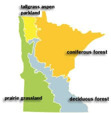
What image comes to mind when you think of “Minnesota?” Most often the land of lakes, rivers, hardwood forests and pine trees is what is portrayed in brochures. Yet the western third of the state was Tallgrass prairie. And mixed in with the deciduous forest zone were areas known as oak savanna, a mix of prairie and trees, predominantly oak. |
Ribbons of Prairie. Where can you find remnant native prairie? And why was Shooting Star Wildflower Route created?
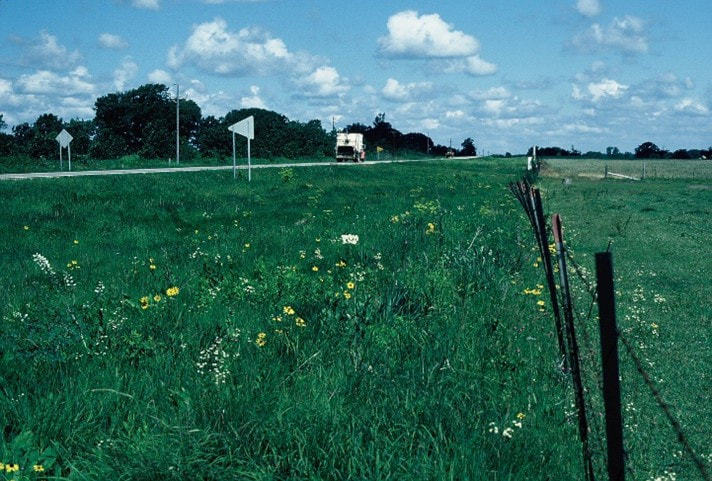
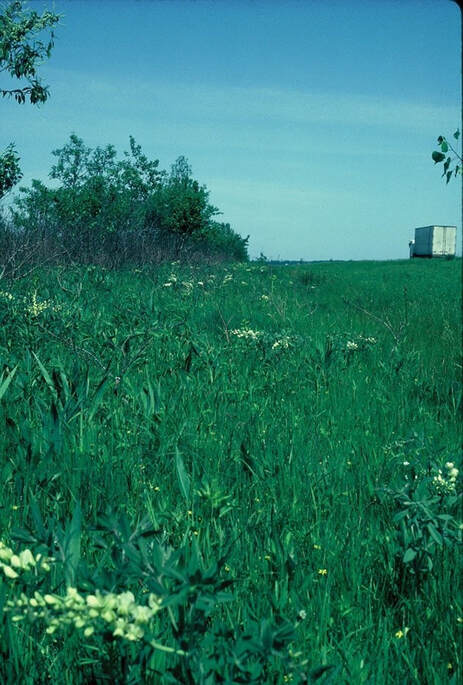
Often sandwiched in the rights of way between the railroad tracks and the roads were remnants of this deep soil rich prairie ecosystem. These ribbons of prairie crossed Minnesota and the mid-section of the United States from Canada to Texas.
It is important to understand that these remnant prairies were not planted, but are pieces of prairie that was here when the early immigrants arrived from Europe. These wedges of prairie are the ecosystems that the indigenous peoples lived in harmony with. They knew the wildlife and the plants well, understood how they functioned and managed them with fire just as is done today.
In 1980 Minnesota State Parks began to restore some of the old farm fields within the parks to what would have been the original vegetation. In many cases this would have been tallgrass prairie and oak savanna. In order to determine what plants were appropriate to the parks lands in Southeastern Minnesota a survey of railroad right-of-ways was begun in search of prairie remnants.
During this survey, several miles of high quality native or remnant prairie were identified, including Highway 56 between LeRoy and Rose Creek. (Other segments included Hwy 218 south of Austin that became a Wildlife Management Area; a small tract of prairie near Keister, later purchased and renamed to Osmundson Prairie, a larger tract that became Ironhorse Prairie, Hwy 218 Austin to Blooming Prairie, and segments along Highway 14 between Owatonna and Rochester. Photos by Kathy Bolin.
Shooting Star Discovered!
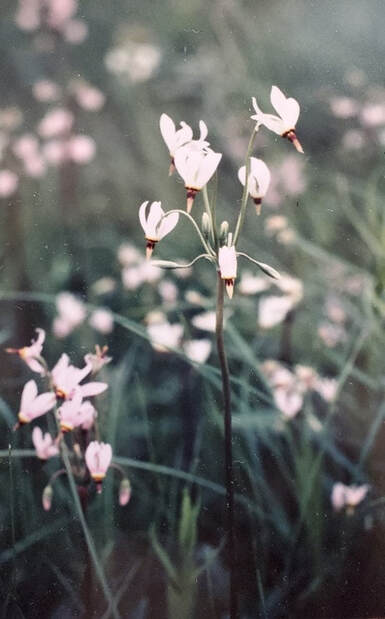
It was during the survey for remnant prairie that west Kathy Bolin, Regional Resource Specialist for Minnesota State Parks, found what she thought looked like the seed stalk to a plant known as shooting star. This was a surprise because that plant grew along the bluffs closer to the Mississippi River. Finding this plant on the right of way just of LeRoy seemed out of place but it looked like the seed stalk of that plant. Given the location the question was whether this was a different species of shooting star, Dodecatheon meadia, a shooting star species not yet found or known to occur in Minnesota. This was exciting! The Minnesota State Botanist was consulted by phone and the plant and the location were described. It sounded promising! The next spring when the plants were in bloom, a photo was sent to the state botanist who ultimately verified that indeed this was Dodecatheon meadia. This was the first and only known location of this species in Minnesota. https://www.minnesotawildflowers.info/flower/prairie-shooting-star
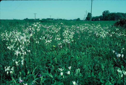
In the early 1980’s there were thousands of shooting star blooming between the highway and on both sides of the railroad tracks. The railroad was being abandoned for rail use so thus began the effort to protect this ribbon of prairie and the only known population of shooting star in Minnesota. An early discussion included working to extend the Root River Bike Trail that was being developed this direction.
In the early 1980’s there were thousands of shooting star blooming between the highway and on both sides of the railroad tracks. The railroad was being abandoned for rail use so thus began the effort to protect this ribbon of prairie and the only known population of shooting star in Minnesota. An early discussion included working to extend the Root River Bike Trail that was being developed this direction.
|
Photos by Kathy Bolin, 1981, HWY 56 ROW
|
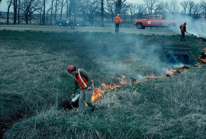
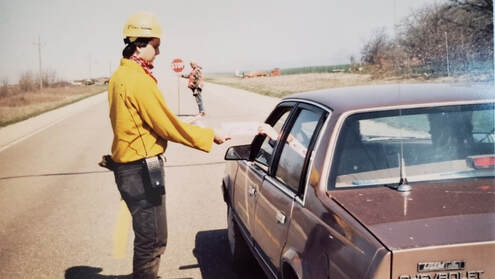
First prescribed burn along Hwy 56, early 1980’s. MNDNR crew providing motorists with information about the right of way and the prescribed burns. MnDNR, Mn DOT, County Sheriff all assisted with the burn and traffic control. Photos by Kathy Bolin.
Mrs. Lyndon “Lady Bird” Johnson and Shooting Star Wildflower Route
Lt. Governor’s Wildflower Task Force Created |
Mrs. Lyndon “Lady Bird Johnson,” is well known for her Highway Beautification work in Texas and was encouraging a national effort to beautify roadsides. Mrs. Johnson began the National Wildflower Research Center in Austin Texas. One of her childhood and best friends was Ida Mae Cain whose husband, Dr. Jim Cain, was President Lyndon Johnson’s doctor. The Cain’s lived in Rochester, Minnesota. Kathy Bolin had met the Cains and invited them to see these ribbons of native wildflowers in Minnesota taking them to see where the population of shooting star grew along Hwy 56. Mrs. Cain was asked to be on the NWR Board of Governors. In May 1983, Mrs. Cain flew to Texas to attend the first meeting of the National Wildflower Research Center Board of Governors. She brought with her a letter from Bolin suggesting that these “ribbons of prairie” be protected and a route be designated connecting the North Star State (Minnesota) with the Lone Star State (Texas). (While the National Wildflower Research Center chose not to get involved in this idea at the time, the idea ultimately did take traction and years later a route was established and became known as Prairie Passage).
|
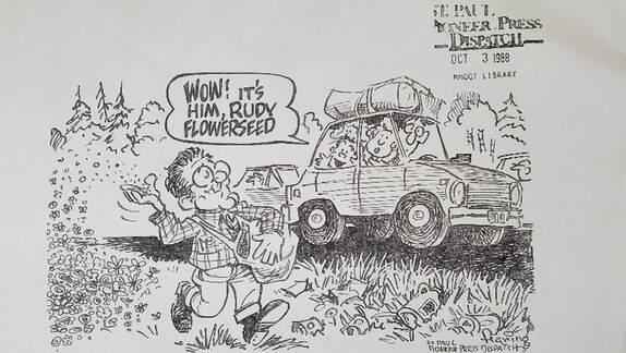
Simultaneously a group of people from Minnesota DOT, DNR, DTED, Hennepin County Parks and private individuals met to discuss the idea of creating State Wildflower Routes in Minnesota. Efforts to protect the prairie right of way remnants continued between Southeastern Minnesota DNR and DOT staff. Dr. and Mrs. Cain were also friends of Governor Rudy and Lola Perpich. Mrs. Cain invited Mrs. Perpich for lunch and to discuss this idea of highway beautification.
As interest in roadside beautification and protection of remnant prairies increased in Minnesota Lt. Governor Marlene Johnson created the Minnesota Roadside Wildflower Task Force in November 1987. This group was charged with making “wildflowers a cornerstone in the beautification of Minnesota’s roadsides.” (From Minnesota Roadside Wildflower Task Force Report and Recommendations, October 1988).
Mrs. Cain suggested that with “increased interest in highway beautification in Minnesota” Mrs. “Ladybird” Johnson should invite the Perpich’s to attend the Annual Texas Highway Beautification Awards Ceremony held at the Johnson Ranch. Governor Perpich attended this event in 1988 (not sure of what year) and learned of the Texas Adopt A Highway Program. On his return from Texas, Governor Perpich asked MnDOT to create an Adopt A Highway Program in Minnesota.
The 30th Anniversary of this program was highlighted by MnDOT in August 2019.
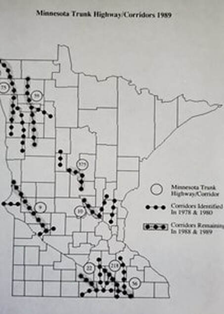
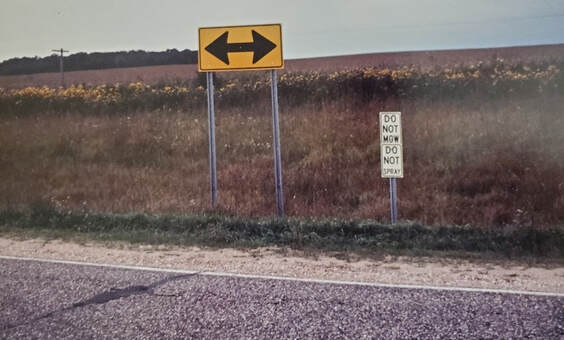
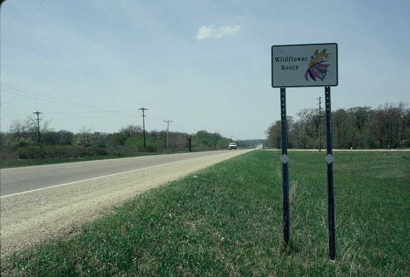
While a Wildflower Route Program was not separately created MnDOT officials created Wildflower Route Signs and using the surveys that had identified rights of way with remnant prairies signed several segments of as State Wildflower Routes. (Photo map of routes). In northern Minnesota one of these routes was a ribbon of orchids! Thousands of orchids. Sadly many of these were later destroyed in reconstruction although hundreds of volunteers moved thousands of orchids in an effort to save them. There are still orchids along some highways in the northern part of the state. Back to Highway 56.
Prairie Visions: From the vision to protect prairie rights of way and the Shooting Star
“The nucleus to unify the spirit of cooperation between our communities.”
|
Beginning in the early to mid 1980’s Minnesota DNR’s Scientific and Natural Area (SNA) Program held a Statewide Prairie Day. Fieldtrips, tours and presentations were given at one of the state’s best or newest protected remnant prairie. This effort invited the local community, neighbors and prairie enthusiasts to see real prairie and learn more about this rare resource. SNA was able to purchase a piece of the HWY 56 right of way where there was remnant prairie but no shooting star. Unfortunately, much of the population of shooting star was destroyed when negotiations to purchase the entire right of way for a future bike trail between LeRoy and Rose Creek failed. Still because the remaining population of shooting star plants was nearby the name Shooting Star Prairie was given to this new SNA and it was decided to feature this site as the 1989 Prairie Day SNA. Bolin was asked to coordinate the 1989 Prairie Day. A meeting was held with the mayors of LeRoy, Adams, Taopi and Rose Creek to see if they would unite in putting on a day long Prairie Day. After a bit of hesitation on “would anyone come” they all agreed that if one town would do something the other towns would also. So plans took place. And enthusiasm grew deep much like the roots of the prairie.
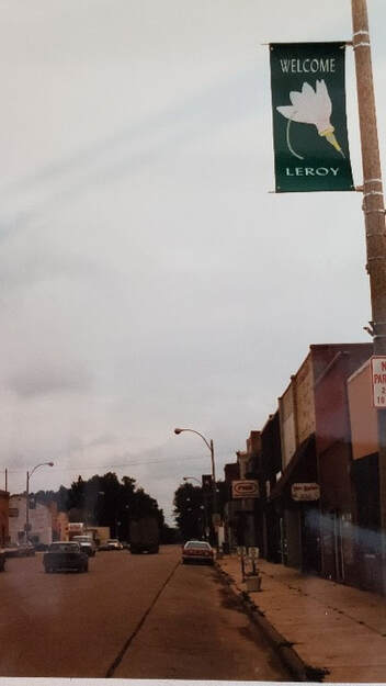
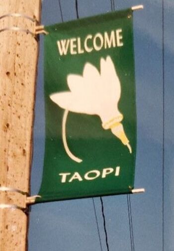
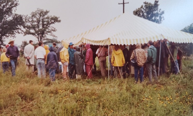
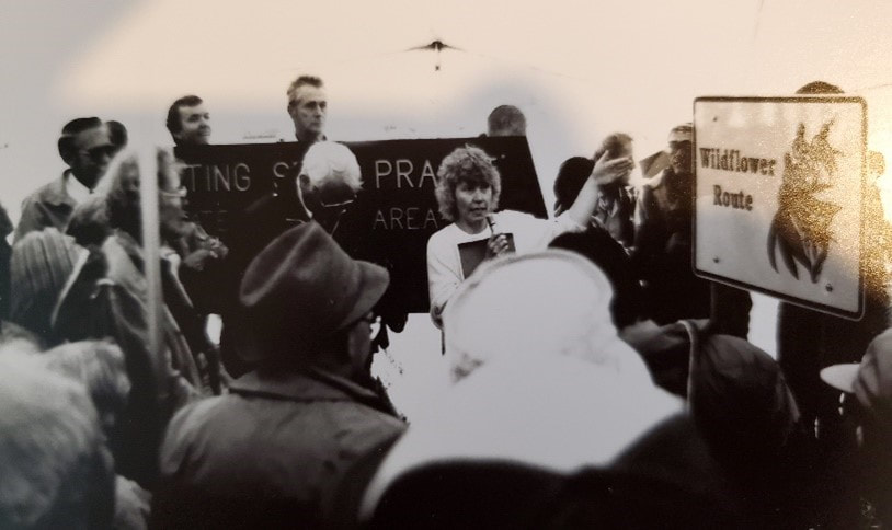
To bring recognition to this route and street banners for each of the four towns were created along with numerous brochures. Hundreds of people attended, in the pouring rain, some from as far away as New York! People who love prairie will travel to see prairie! In his welcome to those who attended the many events, LeRoy Mayor Everett Kintner said, “I always thought I was standing knee-deep in weeds, but here I was knee deep in prairie!” His comments brought laughter but nods of heads and lots of conversation about “little did I know we had this treasure. I’ve been driving past it for years and never knew.” During this same time frame Ruth Murphy, who had grown up in Rose Creek but was now working in community development met with the towns to discuss rural development projects, specifically wind generation. Ruth, as Kinter said it was the prairie right of way that truly united these towns, brought them together. “I didn’t know the prairie was something to be protected,” he (Kinter said). “Now I look at it, and it just seems to unfold and nfold and unfold. It’s become the nucleus to unify the spirit of cooperation between our communities.” (Kinter passed away in 2014) (see article Wild Roadsides: Sept.-Oct. 1991 The Minnesota Volunteer by Kathy Bolin). Praire Day 1989 opened the way for these communities to see the vision that if they worked together there were a lot of possibilities. Thus Prairie Visions was born. |
Color Photos by Kathy Bolin. Black and White by MnDOT. (Wildflower Route signs featured Purple Coneflower and Prairie Coneflower, two species found more commonly across the state).
Shooting Star Scenic Byway
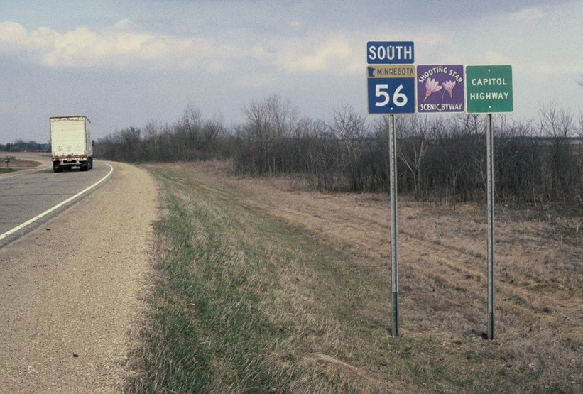
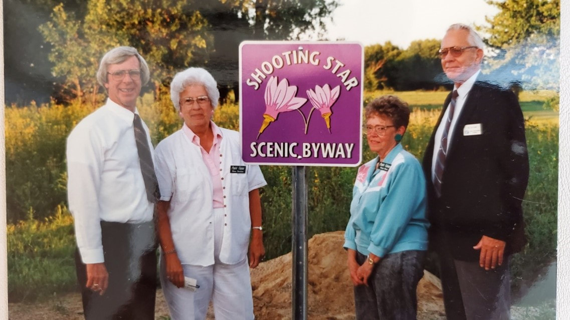
In 1993, Highway 56 between I-90 and the Iowa Border was designated one of Minnesota’s first scenic byways, Shooting Star Wildflower and Historic Route. The wildflowers seen along this route are native, that is, most have not been planted but represent what was once a vast prairie landscape across much of Minnesota. They are historic indeed!
Over the years Prairie Visions and Shooting Star Wildflower Route have received numerous awards and recognitions, featured in local and statewide newspaper articles, calendars, and was featured in a segment of The Osgood File and was going to be featured in a People Magazine article but was cut out by some breaking news out of Washington D.C
May 1996 Certificate of Commendation by Governor Arne Carlson in Recognition of Prairie Visions
May 1999
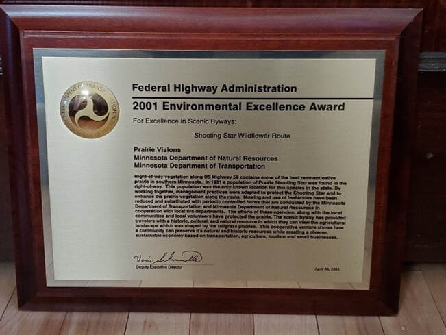
May 2001 National Environmental Excellence Award for Shooting Star Wildflower Route presented by Federal Highway Administration. Prairie Visions President Eileen Hutchins and Kathy Bolin, MnDNR attended the ceremonies in Washington, D.C. to receive the award.
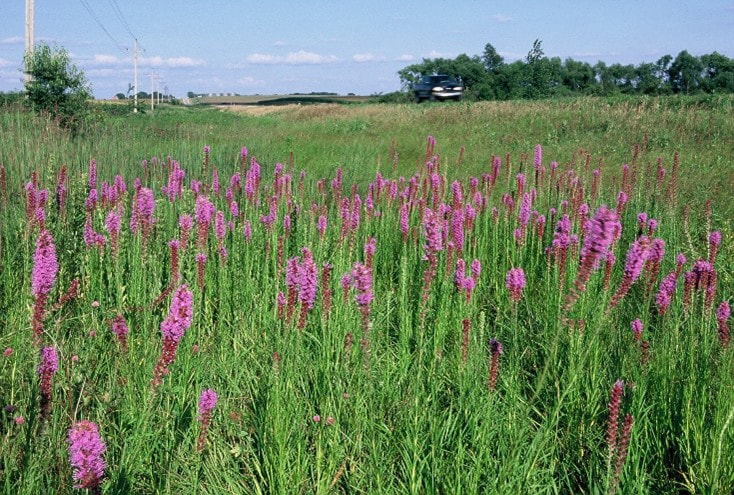
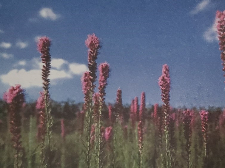
2001 First place in Federal Highway Administration Annual (FHWA) Photo Awards Contest in Category III: Protected Natives for photo of Blazing star (Liatris sp.) taken by David Larson MnDOT along Shooting Star Wildflower Route and Scenic Byway. “Blazing star, a species of Liatris, decorates the ditches of the Shooting Star Wildflower Route and Scenic Byway along US HWY 56 through southern Minnesota. Monarch butterflies are often seen feeding on the variety of Liatris species as they migrate their way south in August and September.” (This is a photo of D. Larson’s Award winning Photo of Liatris.) This photo was featured in the Annual Federal Highway Administration Calendar.
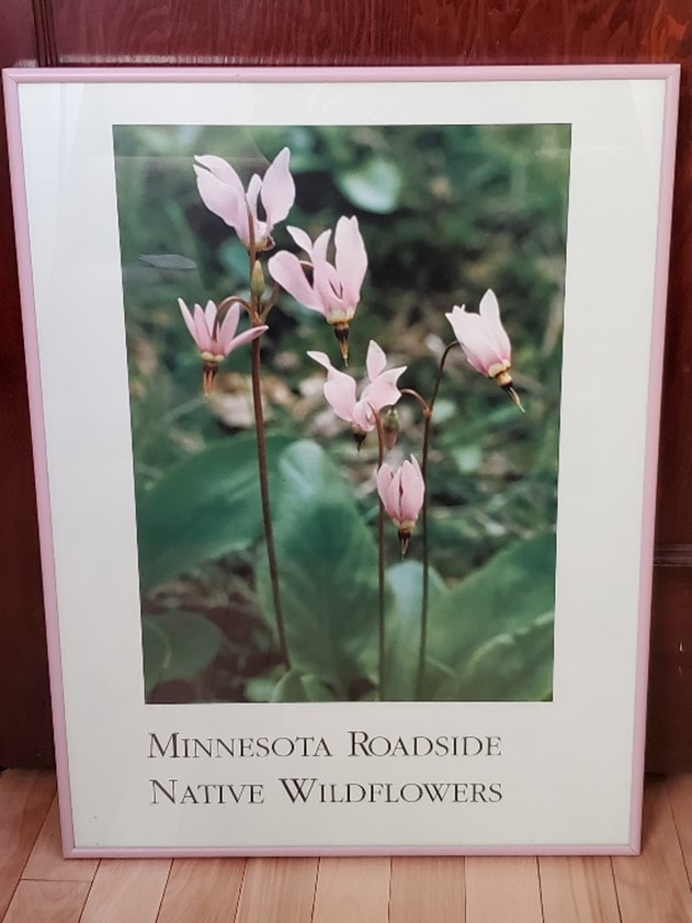
2001 Third place in FHWA Photos Awards Contest in Category III: Protected Natives for Shooting Star (Dodecatheon meadii) Endangered Species in Minnesota. Photo by David Larson MnDOT. This photo was used to create a poster celebrating Minnesota Roadside Native Wildflowers and was distributed widely throughout the state.
Transcript from The Osgood File, July 16, 1998:
OSGOOD: THE OSGOOD FILE. Charles Osgood on the CBS Radio Network. CHARLES OSGOOD reporting: THE OSGOOD FILE, sponsored in part by Northwest Airlines. I'm Charles Osgood.
OSGOOD: There are four small Minnesota towns on the prairie whose vacant storefronts and abandoned railroad stations told a sad story.
MS. KATHY BOLIN (Naturalist): They had very little self-esteem in anything. They didn't know who they were anymore. They were dying as a rural community that was connected tot the land.
OSGOOD: But they had one thing, something of great beauty that could bring life back to the towns. In southeastern Minnesota, small farms and an occasional town dot a rolling, windy prairie where grasses and wildflowers are abundant. When the prairie blooms, it's a delight to naturalist Kathy Bolin.
MS. BOLIN: The yellow that we're seeing is the golden alexander. We walk a little further out, we see some more phlox.
OSGOOD: Most of what was once the vast prairie is gone, though, and the once thriving towns are barely hanging on. LeRoy's Mayor Ed Koppen didn't think the prairie and its flowers were anything special.
MAYOR ED KOPPEN (LeRoy): I didn't know you even termed them wildflowers, and to us, they were strictly weeds.
MS. BOLIN: They had something special in their backyard, and they didn't have a clue about it. They didn't - nobody had bothered to tell them.
OSGOOD: Their great asset was all around them. LeRoy and the surrounding towns had a gold mine, the remaining prairie itself, but it would have to left in its natural state to be a tourist attraction. Eileen Hutchins was the one who realized that if they preserved the prairie, people would come from far and wide to see it.
MS. EILEEN HUTCHINS (Resident): What I dream about is painters come and set up an area where they paint wildflowers and sell their wares, and there's gonna be the people that want to come and watch the birds and sit by the water.
OSGOOD: That dream has brought new life and optimism to LeRoy. A bike path is being built, linking the four prairie towns and attracting the tourists. Mayor Koppen is renovating a turn-of-the-century hotel. He wants to be ready for the visitors he thinks are sure to come.
MAYOR KOPPEN: I watch the cars, and the license plates on those cars are from various states and also heavily out of the metro area, and they are stopping, walking the ditches, taking pictures.
OSGOOD: Residents Marjie Meier and her husband, Gerald, can see brighter days ahead.
MRS. MARJIE MEIER (Resident): There are people that come in here just to photograph flowers. It's gonna go. It'll fly. It just takes a while.
MR. GERALD MEIER (Resident): This is just in an infancy. The prairie's been here all the time, but we're just beginning to use it as a tool
OSGOOD: Naturalist Kathy Bolin says the prairie and its beauty opened a lot of eyes.
MS. BOLIN: They've gone from thinking they were dying to being just so alive and so excited.
OSGOOD: THE OSGOOD FILE. Charles Osgood on the CBS Radio Network. CHARLES OSGOOD reporting: THE OSGOOD FILE, Sponsored in part by CNA. I'm Charles Osgood.
